To view the Journal for MARCH click on this link GOTO MARCH Journals…or click on the “header at the top of this page, select “Journals” for the drop-down menu. If pictures appear missing, use your “refresh” button.
HAPPINESS is to have EVERYTHING
you NEED,
NOT the NEED to have EVERYTHING
This month’s Travel Plans:
14. March 4th Cottonwood, AZ at Verde Valley RVP (TT) x 14 nights (A section!!)
15. March 18th Grand Canyon Village at GC Campground for 4 nights
16. March 22nd Las Vegas at Las Vegas TT Campground for 14 nights
*****************************************
3.14.2019 1pm Thursday
The text italicized h’s been taken from Wikipedia
Archaeological evidence suggests that humans have lived in the Verde Valley for at least 10,000 years. The earliest signs of permanent settlement in the area appear quite a bit later, however, around 600 CE.
It only took about 30 minutes for us to get here,
awesome! About 15 miles.
The ruins of several prehistoric dwellings are scattered in and around the rim of the Well. Their erstwhile inhabitants belonged to several indigenous American cultures that are believed to have occupied the Verde Valley between 700 and 1425 CE, the foremost of which being a cultural group archaeologists have termed the Southern Sinagua.[3] The earliest of the ruins located on the property (with the exception of the irrigation canal), a “pithouse” in the traditional Hohokam style, dates to about 1050 CE. More than 50 countable “rooms” are found inside the park boundaries; it is likely that some were used for purposes other than living space, including food storage and religious ceremonies.
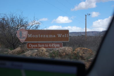
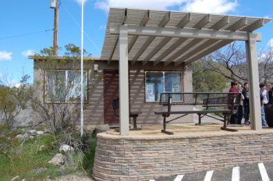
No fees involved just a few rules to obey.
The Sinagua people, and possibly earlier cultures, intensively farmed the land surrounding the Well using its constant outflow as a reliable source of irrigation. Beginning about 700 CE, the Well’s natural drainage into the immediately adjacent Wet Beaver Creek was diverted into a man-made canal running parallel to the creek, segments of which still conduct the outflow today.
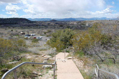
What’s involved here is to ascend about 300 feet to see the Well.
The well is in an area where a source of water is scarce.

The prehistoric canal, estimated at nearly seven miles in length, likely drained into a network of smaller lateral canals downstream, supplying perhaps as much as 60 acres of farmland with water.[3] The route of the modern canal is partly original, especially close to the outlet, but large portions have been re-routed over time as irrigation needs have changed.
People were living here from the 1100’s.
This Well was considered by them to be sacred.
This climb is much steeper than the picture indicates.
Much of the abandoned original route is still visible within the park, however, as the warm water emerging from the Well contains a high concentration of lime, which over many centuries was deposited along the canal walls as the water cooled downstream; the accumulated lime has since hardened into a cement-like coating, preserving the canal’s shape.since hardened into a cement-like coating, preserving the canal’s shape.
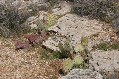
This picture is really all about the cacti plants.
The existence of the Well was almost unknown to European Americans before the publishing of Handbook to Arizona by Richard J. Hinton in 1878. In 1968, Montezuma Well was the subject of the first ever underwater archaeological survey to take place in a federally managed park, led by archaeologist George R Fischer.
This is what the climb was all about.
We were told that the
water has always been arsenic laced.
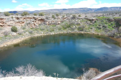
the Yavapai people consider the Well a deeply sacred site, as they believe it is the place through which they emerged into the world.
The trip was nice and the knowledge acquired was extremely interesting. Not sure if I would make the trip again.
“Everything we were, we carry with us.
Everything we will be, is calling to us,
from the roads not travelled yet." pjgrenier