Please take the time to leave a comment at the bottom of this blog. I relish the positive ones and will learn from the negative ones.
HAPPINESS is to have EVERYTHING
you NEED,
NOT the NEED to have EVERYTHING
TRAVEL ITENERARY
March 22nd Las Vegas at Las Vegas TT Campground for 14 nights
April 5th St. George, Utah (119m) x13 nights (119m)
April 19th Kanab, UT at Crazy Horse RVP (80m)x7 nights (80m)
April 26th Salina, UT at RPI RVP(163m) x7 nights (163m)
May 2nd Moab, UT at KOA Campground (159m)x4 nights (159m)
May 6th Heber, UT Mountain Valley RVR (2 overnights) x7n 234m
May 16th Bend, OR TT (Overnights and stays TBD) (654m)(x7n)
June 5th Whaler’s Rest in Newport, OR.
June 26th leave Whaler’s Rest
*****************************************
4.19.2019 Bryce Canyon Park part of Zion.
This article is Courtesy of the National Park Service
Bryce Canyon National Park lies on the eastern edge of the Paunsaugunt Plateau in south central Utah.

Bryce Canyon National Monument (administered by the U.S. Forest Service) was originally established on June 8, 1923 to preserve the “unusual scenic beauty, scientific interest, and importance.”
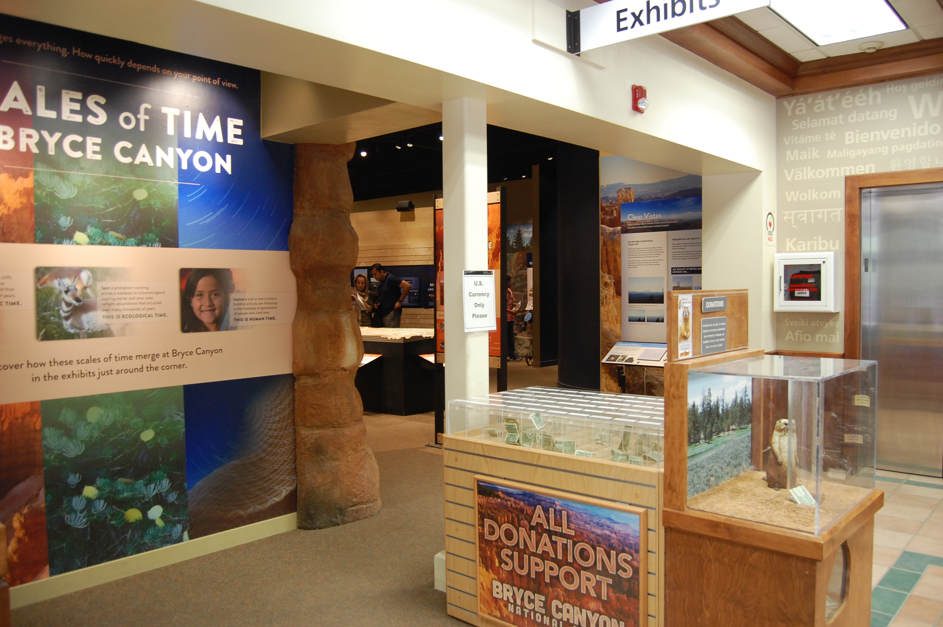
The Visitor’s Center
On June 7, 1924, the monument’s name was changed to Utah National Park and it was transferred to the National Park Service. On February 25, 1928 Utah National Park was changed to Bryce Canyon National Park. Subsequent legislation enlarged the park to its current size of 35,835 acres.

The route we will follow up to, but not including MM11. Site 11 is still impacted with snow.
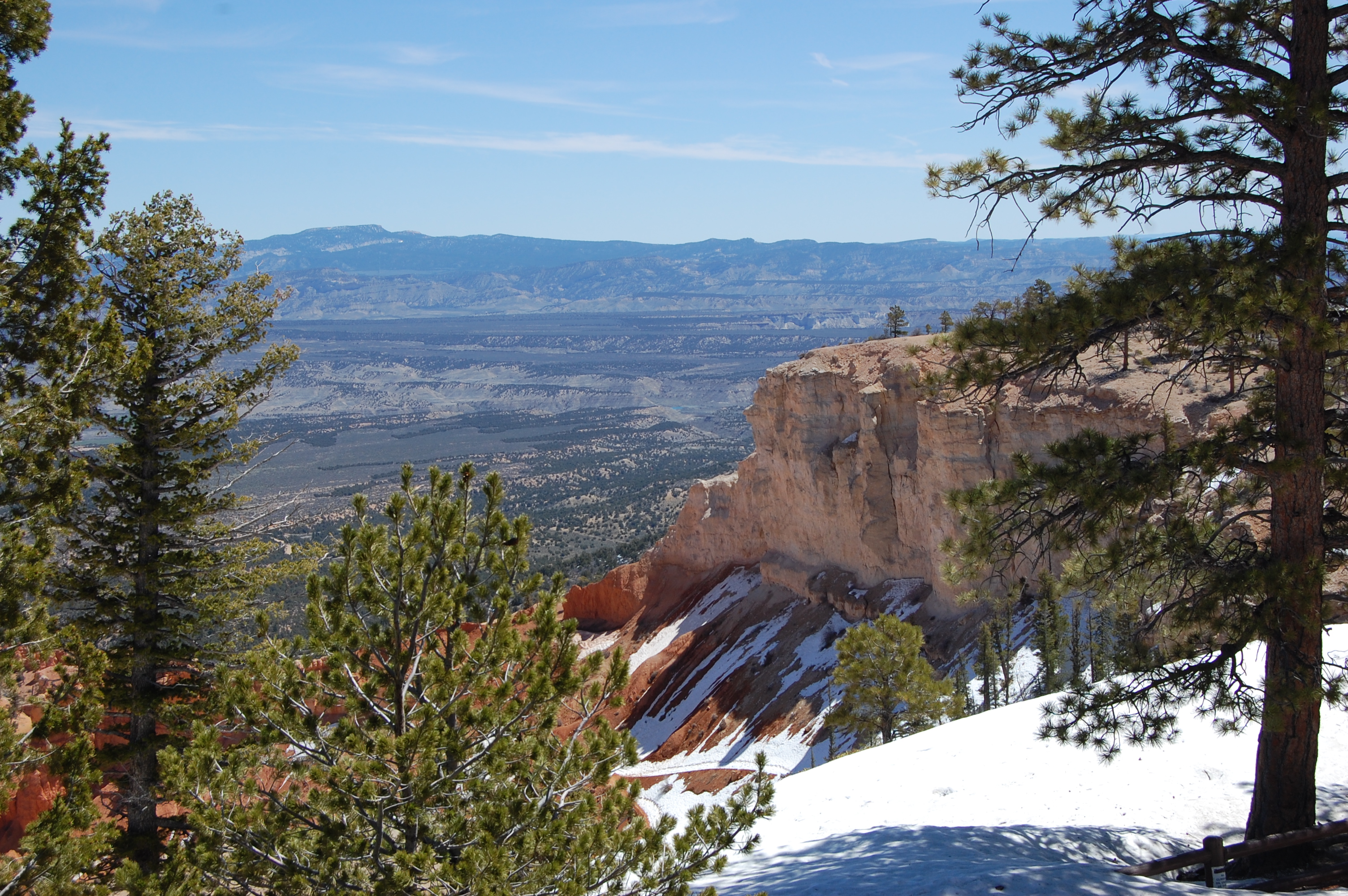
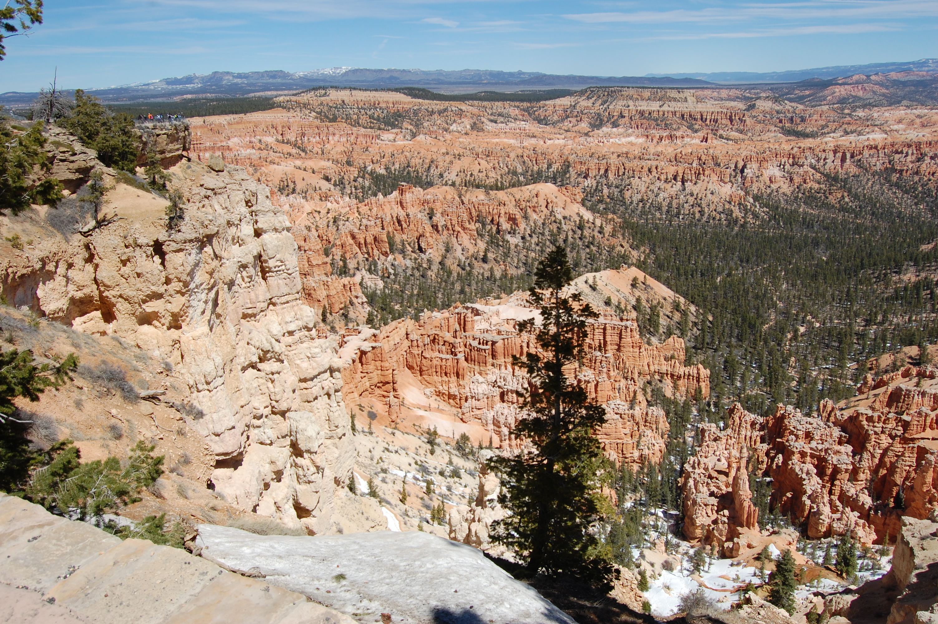
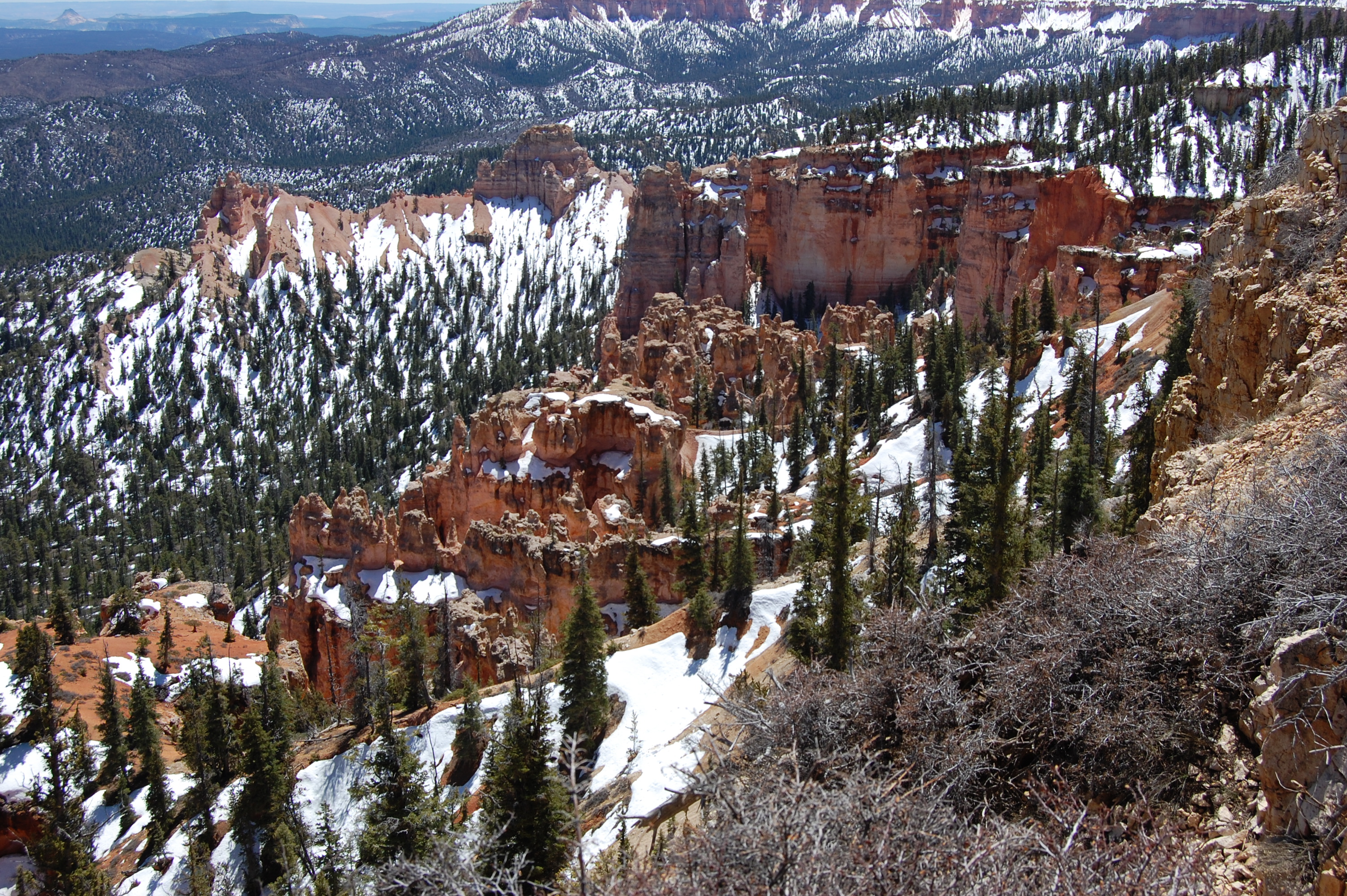
Bryce is famous for its unique geology, consisting of a series of horseshoe-shaped amphitheaters carved from the eastern edge of the Paunsaugunt Plateau in southern Utah.

The erosional force of frost-wedging and the dissolving power of rainwater have shaped the colorful calcium-rich mudstone of the Claron Formation into bizarre shapes including slot canyons, windows, fins, and spires called “hoodoos.”

Columns seen at the bottom of the picture are Hoodoos.
Tinted with colors too numerous and subtle to name, these whimsically arranged rocks create a wondrous landscape of mazes, offering some of the most exciting and memorable walks and hikes imaginable.

As much as I like to pretend that Carla and I are climbing cliffs and leaning over them as well, it’s not true. What you see above is the type of climbing and walking we do most of the time. The National Park Service walkways are not generally this nice or this big, but they are paved
Ponderosa pines, high elevation meadows, and fir-spruce forests border the rim of the plateau and abound with wildlife. This area boasts some of the world’s best air quality, offering panoramic views of three states and approaching 200 miles of visibility. This, coupled with the lack of nearby large light sources, creates unparalleled opportunities for stargazing.

This Canyon is named after this couple, they discovered it and brought it to the attention of the public. Ebenezer and Mary Bryce.>….
One of the first questions people ask when visiting the rugged wilds of southern Utah is, “Who would live here?” The answer is, “Many different cultures over thousands of years have foraged, hunted and survived in this wilderness.”

This self guided tour we’re on for ten miles is divided into
individual sites and views. Without going into more detail than
necessary I’m attempting to entice you with a small smattering of images along this trip
Historic Resource Study
Introduction: Small by National Park standards, the 56.2 square miles of Bryce Canyon National Park occupy the eastern edge of the Paunsaugunt Plateau in south-central Utah. The park is not a canyon. Rather, it is a spectacular series of more than a dozen amphitheaters, each of which is carved at least 1,000 feet into the chromatic limestone of the Paunsaugunt Plateau. …
Just a few more pictures to end this blog. Red Canyon and Bryce Canyon are as exciting, if not more exciting, than the Grand Canyon.
 x
x 
Tripping to one of the last viewing locations. Needless to say were going uphill and our elevation, right now, is over 8000 feet./font>
 x
x 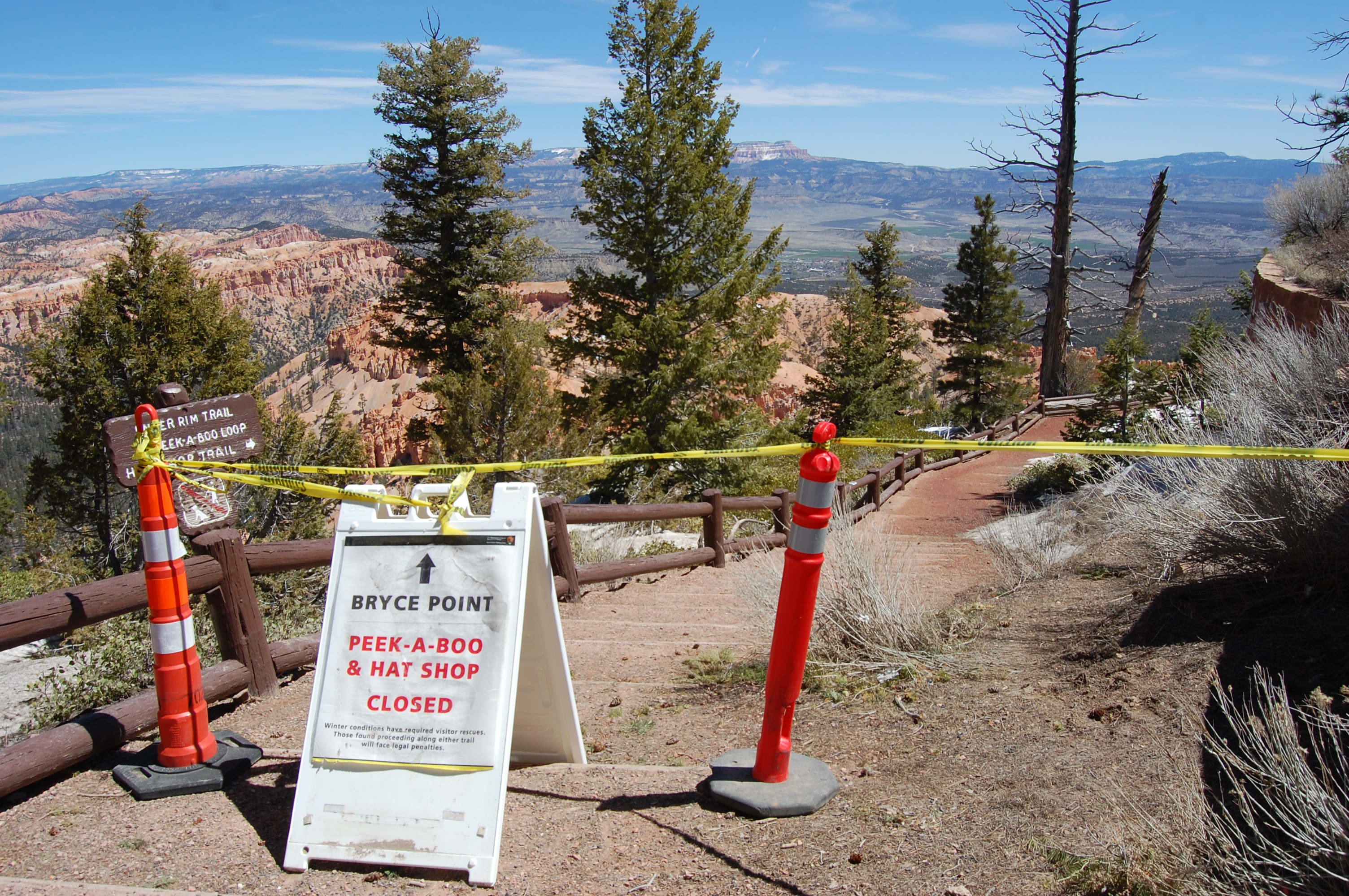
To the NPS’s Credit, this is what the viewing trails used to look like before they retrofit them with concrete
 x
x 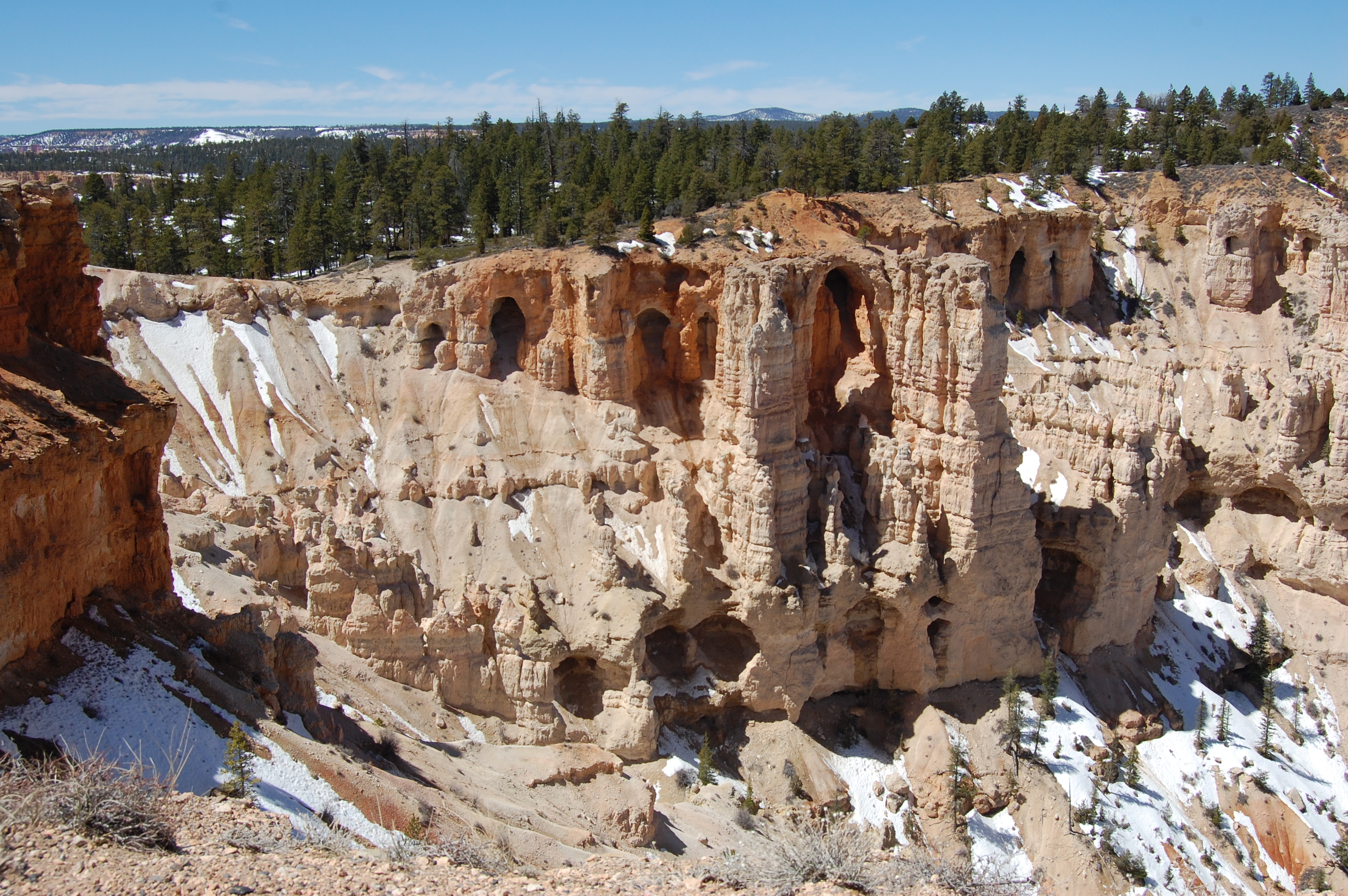 x
x 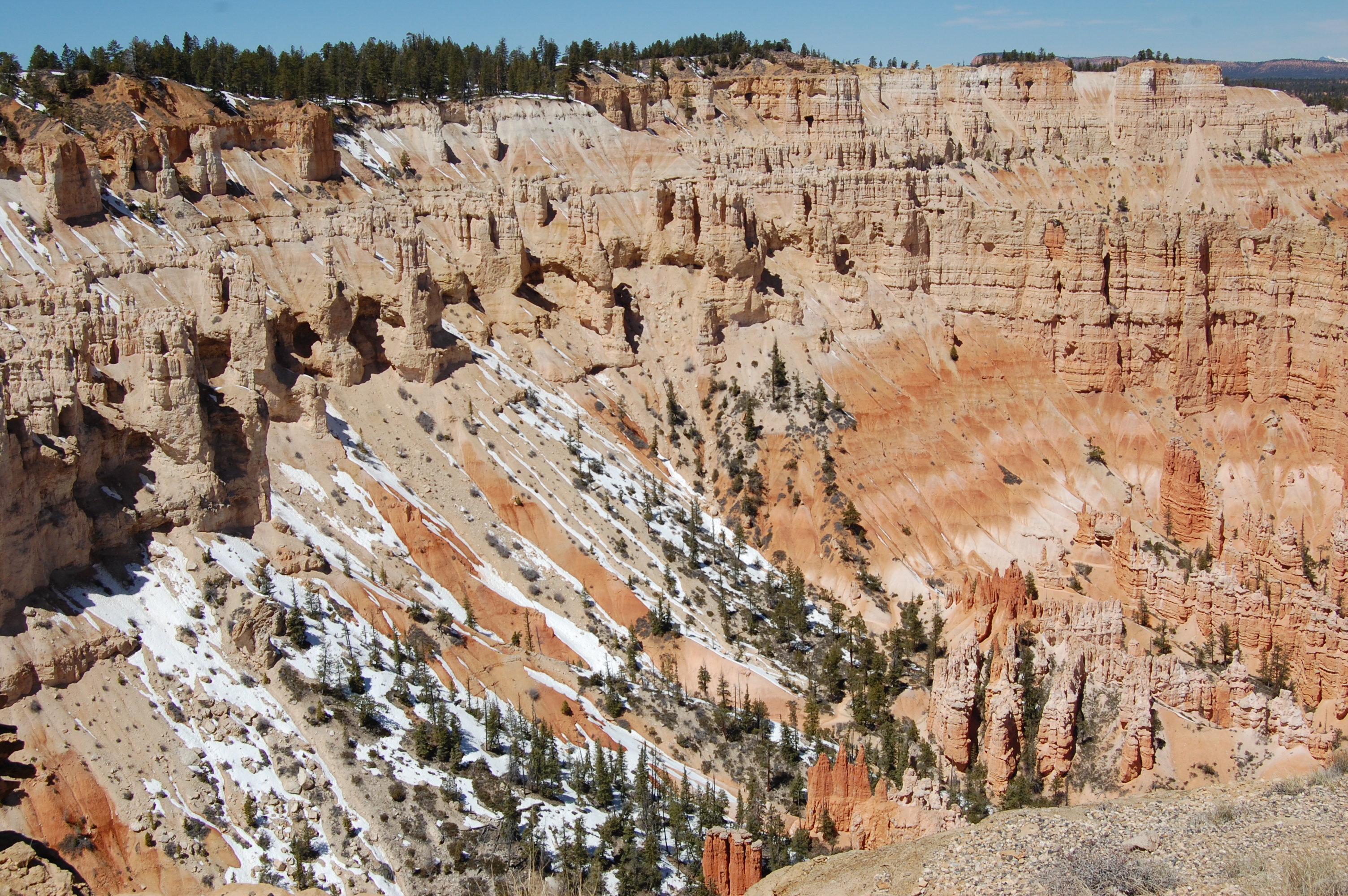 x
x 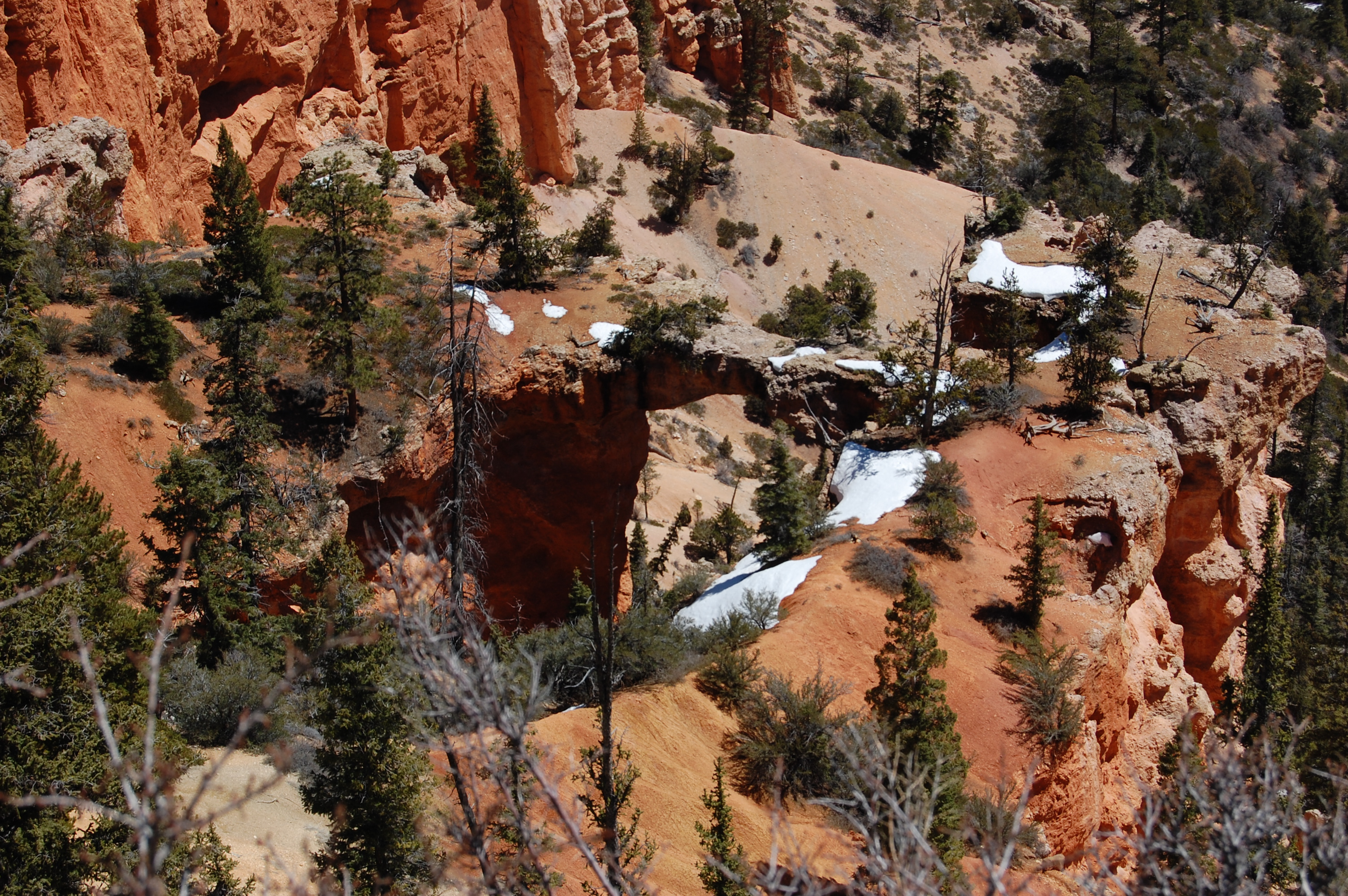
The final leg of our tour is around nine-thousand foot level and yes, snow abounds everywhere.
“Everything we were, we carry with us.
Everything we will be, is calling to us,
from the roads not travelled yet." pjgrenier
orange-red
blue….